How to Find Property Boundaries in Queensland (QLD)
Knowing the exact boundaries of a property is essential for various reasons, whether you are a homeowner, buyer or investor. Understanding property boundaries in Queensland (QLD) ensures that you can make informed decisions about land use, construction and property rights. In this article, we will explore different methods to find property boundaries in QLD and discuss the importance of conducting due diligence before buying a property. Additionally, we will touch up on flood maps and the potential threat of bus fires.
What’s the meaning of a property boundary?
Property boundaries are the legal lines that define the exact edges of a block of land. They mark where one property ends and another begins, based on survey measurements recorded in the official title documents and cadastral maps. These boundaries determine the precise limits of ownership, guiding where you can build, fence, landscape or carry out improvements. In QLD, property boundaries are established through registered surveys and are legally recognised even if an existing fence doesn’t sit perfectly on the line. Understanding this helps prevent disputes, protects your rights as an owner and keeps future projects compliant.
Finding Property Boundaries in Queensland (QLD)
Method 1: Title Deed and Plan of Survey
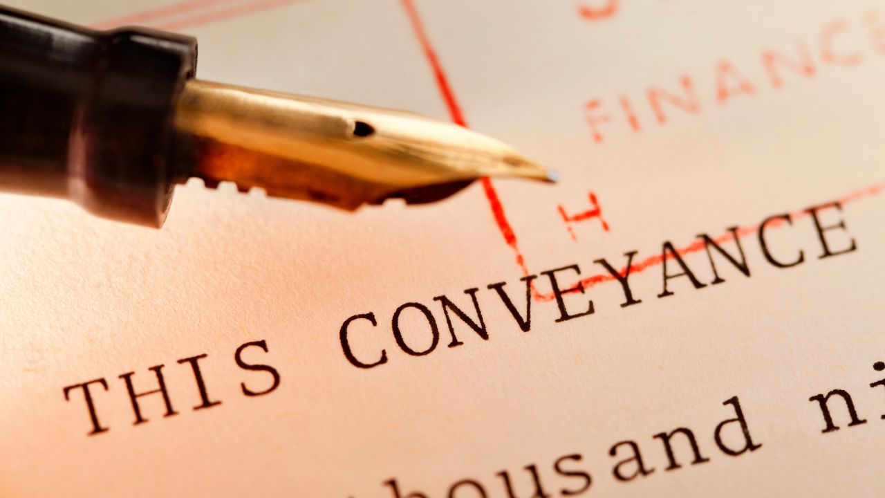
The first and most reliable method to find property boundaries in QLD is by referring to the title deed and plan of survey. These documents provide an accurate depiction of the property’s legal boundaries. The title deed contains information such as lot number, land size and boundary measurements. The plan of survey, also known as a cadastral survey plan, shows the property’s dimensions, boundaries and adjoining properties. To access these documents, you can visit the Queensland Government’s Department of Natural Resources, Mines and Energy website or contact your local land registry office. It is recommended to seek professional assistance from a licensed surveyor or conveyancer to interpret the information correctly.
Method 2: Surveyor’s Pegs or Boundary Markers
In some cases, surveyor’s pegs or boundary markers may be physically installed on the property to indicate the boundaries. These markers are typically small metal or wooden stakes placed at specific intervals along the property lines. While they can be helpful in identifying approximate property boundaries, it is important to note that these markers may deteriorate over time or be removed accidentally. Therefore, relying solely on surveyor’s pegs may not always provide precise boundary information.
Method 3: Engage a Licensed Surveyor
For precise and accurate determination of property boundaries, it is advisable to engage a licensed surveyor. Surveyors possess the expertise and tools necessary to conduct a comprehensive survey of the property. They use advanced equipment such as GPS receivers and total stations to measure and map out the exact boundaries. A licensed surveyor will also provide you with a detailed survey plan, which can be used as legal documentation for boundary disputes or development purposes.
Method 4: Online Mapping Tools
Several online mapping tools and applications are available that provide aerial imagery and property boundary overlays. These tools can give you a general idea of the property’s boundaries, but they should not be considered as the final authority. It is always recommended to verify the information obtained from online mapping tools with official land records and surveys.
Conducting Due Diligence Before Buying a Property
Before purchasing a property in Queensland, it is crucial to conduct due diligence to ensure you are making an informed decision. Here are some key steps to follow:
- Property Inspection: Visit the property and assess its condition, potential risks and suitability for your needs. Look for any encroachments or inconsistencies with the property boundaries.
- Title Search: Obtain a copy of the property’s title deed and review it thoroughly. Pay attention to any encumbrances, easements, or restrictions that may impact your intended use of the property.
- Survey and Plan of Survey: Engage a licensed surveyor to conduct a survey and provide a plan of survey. This will help you verify the property boundaries and identify any potential issues or discrepancies.
- Local Government Checks: Contact the local council to inquire about any development plans, zoning regulations or building restrictions that may affect the property.
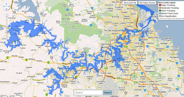
- Flood Map and Environmental Assessment: Check the relevant flood maps and conduct an environmental assessment if necessary. This will help you evaluate the property’s susceptibility to flooding or other environmental risks.
- Professional Advice: Seek advice from professionals such as lawyers, conveyancers and property inspectors to ensure you understand all legal and technical aspects of the property and its boundaries.
By conducting due diligence, you minimise the risk of unexpected surprises and make an informed decision about the property purchase.
The Importance of Flood Maps and Bush Fire Threat Awareness
Flood Maps
In Queensland, due to its diverse geography and climate, it is crucial to be aware of flood-prone areas. Flood maps, available through local government authorities or online resources, provide information about flood risks in specific locations. Understanding the flood map for a property can help you assess potential flood hazards and make informed decisions regarding property development, insurance coverage, and emergency preparedness.
Bush Fire Threat
Bush fires can pose a significant threat to public safety, especially in high-risk areas prone to wildfires. It is crucial to be aware of potential dangers and take necessary precautions. Authorities and government agencies work diligently to enforce safety measures, conduct inspections and implement fire prevention strategies. Stay informed about safety guidelines, familiarise yourself with evacuation procedures and promptly report any concerns to help maintain a safe environment in bushfire-prone regions.
FAQs
FAQ 1: How accurate are online mapping tools for finding property boundaries in QLD?
Online mapping tools can provide a general indication of property boundaries but may not always be entirely accurate. It is advisable to refer to official land records and surveys for precise boundary information.
FAQ 2: What is the role of a licensed surveyor in determining property boundaries in QLD?
Licensed surveyors have the expertise and equipment to conduct accurate surveys and provide detailed survey plans. They play a vital role in defining property boundaries and resolving boundary disputes.
FAQ 3: How can flood maps help in property decision-making?
Flood maps provide valuable information about flood risks in specific areas. Understanding flood-prone zones can help property owners and buyers make informed decisions regarding development, insurance and safety measures.
FAQ 4: What precautions should be taken regarding the threat of bush fires when buying a property?
When buying a property in a bushfire-prone area, it is crucial to consider the threat of bushfires and take appropriate precautions. Here are some precautions to consider:
- Research the bushfire risk: Conduct thorough research to understand the level of bushfire risk in the area. Check local maps and government websites, and consult with local authorities or fire services to assess the history and frequency of bushfires in the region.
- Seek professional advice: Engage a qualified professional, such as a building inspector or bushfire consultant, to assess the property’s bushfire risk. They can provide valuable insights into factors like vegetation, property design, construction materials and other considerations that affect bushfire resilience.
- Consider the property’s location and surroundings: Evaluate the property’s proximity to dense vegetation, national parks or areas with a high fuel load. Properties located near such areas are typically at higher risk. Also, consider the direction of prevailing winds and potential fire pathways.
- Review building construction and materials: Examine the property’s construction materials and design for fire-resistant features. This includes non-combustible external cladding, ember-resistant vents, and fire-rated windows. Ensure that the property meets or exceeds local building codes and bushfire building standards.
- Assess access and water supply: Evaluate the accessibility of the property for emergency services during a bushfire. Adequate access roads, driveways and clearances for firefighting vehicles are essential. Additionally, check the availability of a reliable water source for firefighting purposes.
- Review insurance coverage: Consult with insurance providers to understand the availability and cost of bushfire insurance coverage for the property. Some high-risk areas may have limited coverage options or higher premiums.
- Develop a bushfire survival plan: Create a detailed plan outlining evacuation routes, emergency contact numbers, and procedures to follow in the event of a bushfire. This plan should consider the property’s specific characteristics and the surrounding bushfire risk.
- Stay informed and participate in community initiatives: Stay updated on local bushfire preparedness initiatives, community firefighting groups, and community education programs. These resources can provide valuable information and support in preparing for and responding to bushfire threats.
- Consult with professionals during due diligence: When undertaking due diligence for a property purchase, engage professionals such as solicitors, town planners, and land surveyors to ensure compliance with local regulations and assess any additional planning overlays or restrictions related to bushfire hazards.
- Attend local community meetings: Attend local community meetings or forums to connect with residents, learn from their experiences and gain insights into local bushfire preparedness efforts.
By considering these precautions, you can make an informed decision when buying a property in a bushfire-prone area and take steps to mitigate the potential risks associated with bushfires. Remember to consult with local experts and authorities to ensure you have the most up-to-date information and guidance specific to your location.
FAQ 5: How do I order an official survey plan or title search in QLD?
To obtain an official title search or survey plan in Queensland, you can go through Titles Queensland (the state’s land registry). You’ll need the lot and plan number or the address of the property. You can order online and pay the applicable search fee. For a survey plan specifically, you may need to request a “plan-of-survey” or cadastral plan, and this may also involve engaging a licensed surveyor if you need updated boundary markers.
FAQ 6: What should I do if a neighbour is encroaching on my property boundary?
If you believe a neighbour’s structure or fence crosses your property boundary in QLD, first check your title documents and plan of survey to confirm the legal boundary exists. If encroachment is evident, attempt polite negotiation with the neighbour. If informal resolution fails, you can seek legal advice. Under the Property Law Act 1974, you may apply for orders to remove or compensate for the encroachment. You may also use mediation or apply to the Queensland Civil and Administrative Tribunal (QCAT) to resolve disputes.
FAQ 7: Can I rely on boundary fences to determine my legal property lines in QLD?
No. You cannot rely solely on a fence to determine your legal property boundary in QLD. A fence location may not reflect the true legal boundary if it was built incorrectly or moved. The legal boundary is defined by survey monuments and the recorded plan of survey on the title. If the fence sits off the legal boundary line, you may inadvertently give away land or incur a boundary dispute. Before making improvements or deciding costs, engage a licensed surveyor to verify the true boundary line.
Making Confident Decisions With Clear Property Boundary Information
Knowing the property boundaries in QLD is essential for property owners, buyers and investors. By referring to title deeds, engaging licensed surveyors and conducting due diligence, you can ensure accurate boundary information. Additionally, understanding flood maps and being aware of potential bush fire threats contribute to informed decision-making and public safety. Always seek professional advice and follow proper procedures to make confident and well-informed property-related decisions. To purchase a Pre-Purchase report which has information in relation to boundaries, flooding, bush fire threat and much, much more click here. This is general advice only, for specific legal advice, speak with your expert legal representative.